- Telephone: (+357) 24 646 444
- FAX: (+357) 24 645 180
LOCATION
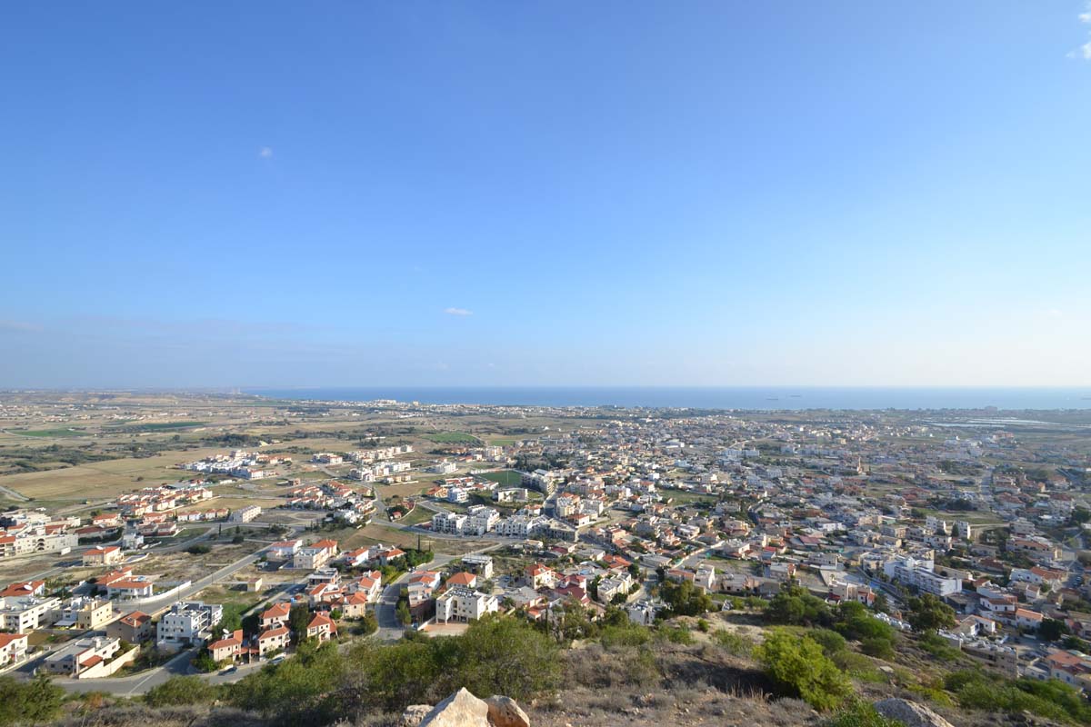
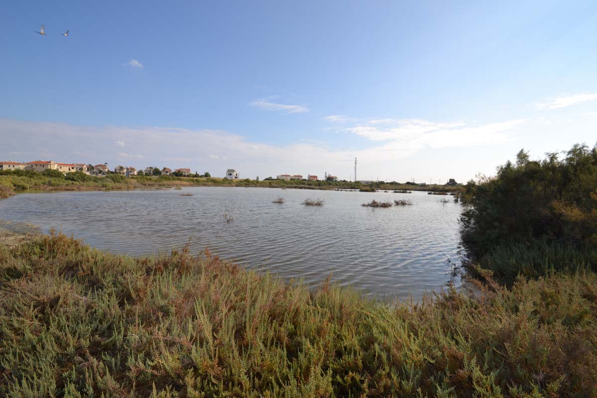
Voroklini is located approximately eight kilometers northeast of the city of Larnaca. The village is situated on a hill, at the foot of a low horseshoe-shaped elevation, about 50 meters above sea level. Voroklini receives an average annual rainfall of around 340 millimeters, and in its region, cereals, vegetables, and fruit trees are cultivated.
A notable feature of the landscape is the elongated hill called Arodafni, located to the northwest of the village. Its peak, known as Gerakomoutti, reaches an altitude of 208 meters. On the southern part of this long hill stands the chapel of Prophet Elias.
Voroklini is connected to the southwest with the Larnaca–Famagusta highway, to the northwest with the quarries and mines located between Voroklini and the villages of Troulloi and Avdellero, and to the northeast with the nearby mixed village of Pyla, which is about 3 km away. To the north is the monastery of Saint George of Mavrovouni, which flourished during the Venetian period. To the west, it connects with the village of Livadia.
POPULATION
Due to significant population growth, the village has evolved into a large and developing community. In 1878, the population was 150. By 1881 it had grown to 260, in 1911 to 410, in 1946 to 611, in 1976 to 811, and by 1982 it reached 1,315. In the 2001 census, the population stood at 3,302.
QUARRYING
Other notable features of the area include the numerous quarries (stone, lime, umber, and gypsum) and mines (copper and gold), which appear to have existed since ancient times. It is certain that apart from farming, locals were also employed in the many quarries and mines. These mines, located between Troulloi, Avdellero, and Voroklini, are the only ones developed away from the foothills of the Troodos mountains, where the rest of Cyprus’s mines are found.
It is rumored that the renowned French poet Arthur Rimbaud worked in the quarries of Voroklini in the late 19th century.
NAME OF THE VILLAGE
According to Grivaud, the village has been known by the names Porocumi, Voroclini, and Voroklini.
Nearchos Clerides notes that the commonly used name “Oroklini” probably does not derive from the words oros (mountain) and krini (spring), since many villages in Cyprus have springs on mountain slopes.
Clerides suggests that the name “Voroklini” may originate from the village’s springs, whose water is brackish. This is supported by oral accounts. Another possible version is that it comes from the words oros (mountain) and klinin (rich/abundant), referring to the abundant water that once flowed from the mountain slopes.
HISTORICAL SITES
Important historical sites (according to Goodwin) include:
- The Despot’s estate (south, between Voroklini and Pyla), likely destroyed during Saracen raids (Machairas),
- The estate of Diazenas (location “Kafkalies”),
- The estate of Santis (within the village),
- Saint Thomas, located about 1.5 km north of the current village,
- Saint George of Mavrovouni, about 1.5 km north of Saint Thomas, known also as the feudal estate San Zorzi.
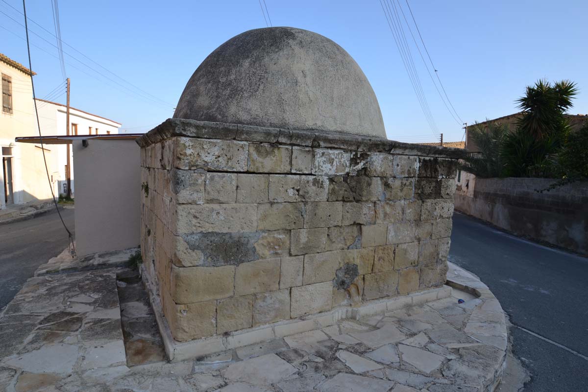
In this area, there were also umber mines. The church at Saint Thomas has been declared an ancient monument by the Department of Antiquities, as has the Hellenistic-period cemetery at the site “Lakkos tis Elias.”
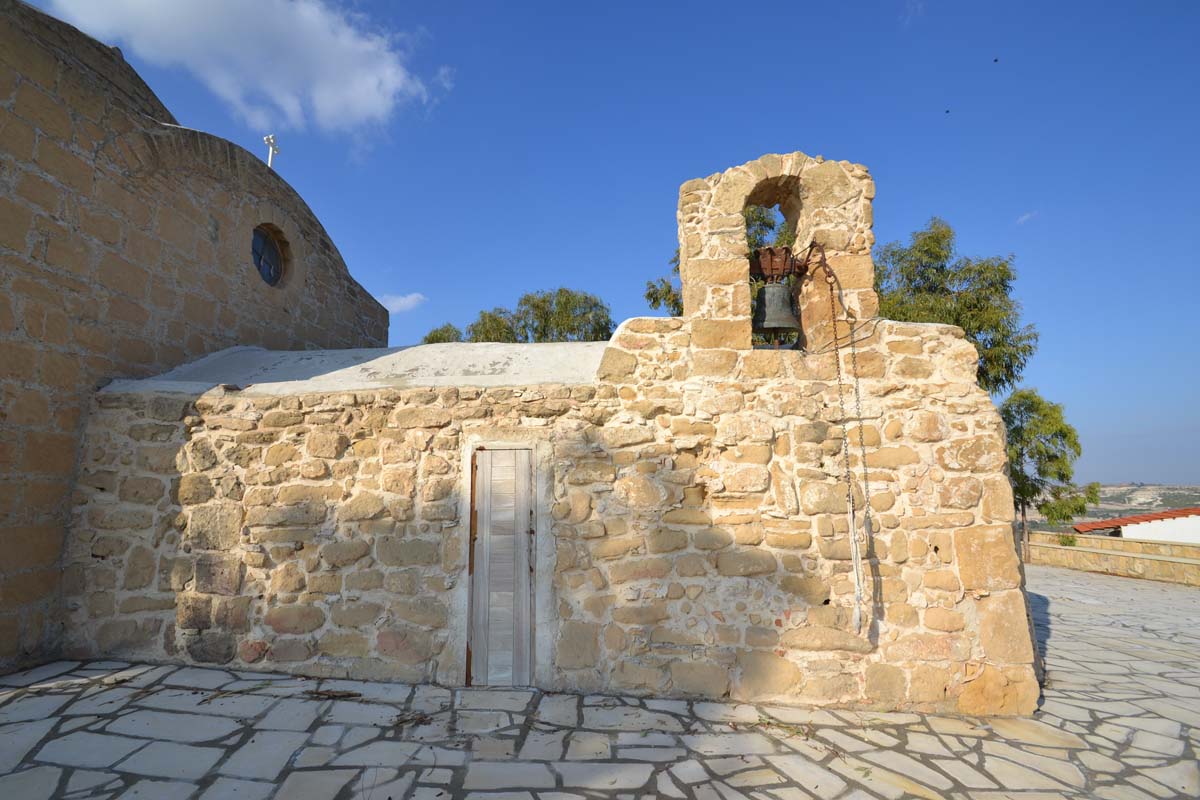
The church of Prophet Elias marks the southwestern boundary of the village and is visible from most parts of it. To the northwest of the church, closer to the village, lie ancient rock-carved steps known to locals as “the steps of the Prophet.”
According to map D.O.S. 355 from 1960, a settlement and a Late Bronze Age cemetery were identified at the site “Verki,” north of the river’s mouth.
Southeast of the village, 700–800 meters from the center, lies the abandoned site where traditional mud bricks (plintharia) were made (map D.O.S. 355). North of the site Azousa, the same map shows rows of pens believed to date to the late 19th century.
HISTORICAL REFERENCES
The area seems to have been inhabited since ancient times, as evidenced by the intensive exploitation of mineral resources in the Troulloi area, particularly copper, umber, and white clay.
Grivaud, citing Mas Latrie, reports that the village and others in the area were abandoned in the 15th century. He also notes the village was specifically abandoned in 1572. These were temporary abandonments, as confirmed by Ottoman documents (defter-i-muufassal of 1572), due to raids, unstable sociopolitical conditions, and epidemics (Grivaud, 218, 220).
However, in the rare 1570 map by Jacomo Franco, printed in Venice and considered the most accurate of its time (later copied by Abraham Ortelius in 1573), the village is shown under the name “Voroclini.” Interestingly, the location of the village is reversed with that of Pyla (Hadjipashalis and Ioannou, 1989).
The village appears on other Venetian maps as “Vorochini” in the 17th century (Goodwin) and in French consulate documents (MKE) as “Verochino.”
Leontios Machairas, in the fifth book of his Chronicle, mentions Saracen raids in the area during the reign of King Janus (1398–1432):
“…and on Friday, the 10th of August, news arrived…that the Saracens had burned Kellia and Aradippou and the entire Despot’s plain…” (Pavlides, 1995).
During Ottoman rule, the village was deserted but began to regain population in the 18th century (Great Cypriot Encyclopedia).
In 1878, Arthur Rimbaud is said to have worked in the area’s quarry. Goodwin states he earned six pounds per day. At the same time, the infamous antiquities looter Luigi Palma di Cesnola, the U.S. consul, was conducting excavations, though there is no clear reference to Voroklini specifically (Hatzikosti, 2001).
In 1885, Horatio Kitchener completed mapping Cyprus at a scale of one inch to one mile. On this map, the village of Voroklini appears in its current location, with the church and four parallel roads.
George Jeffery (1918) briefly describes it as “…an ancient settlement found in old maps, surrounded by abandoned chapels…”
According to local tradition, the village was originally located northeast of the current one, at the site of Saint Thomas. During epidemics, livestock was first moved near the spring of Saint Catherine, followed by the rest of the population.